Day 2 (August 2019)
Conchas Lake –> Las Vegas –> Mora –> Coyote Creek State Park –> Angel Fire –> Eagle Nest Lake –> Red River –> Questa –> Rachos de Taos

NM-104 and Trementina
Upon departing Conchas Lake State Park, we continue north on lonely NM-104, a true treat of a blue highway. We pass Trementina, a tiny unincorporated area whose residents are mostly ranchers and/or Scientologists. Trementina is the location of a secretive and highly secured Scientology base and vault where founder L. Ron Hubbard’s archives are preserved. The base even has its own airstrip, so perhaps Tom Cruise or John Travolta may have been visiting when I passed by. What can only be seen from the air is the religion’s symbol, which has been carved into the ground. Why? Rumor has it that the symbol is there to guide Hubbard back to earth when he returns from death and beyond.
I find the word Trementina quite melodic and appealing to the ear. Trementina “is the Spanish word for turpentine, in reference to the pitch of the pinion pine, which was used by Spanish Americans as a folk medicine and substitute for chewing gum.” Thanks Wikipedia!
I do not stop in Trementina, as I’m a little scared I’ll be imprisoned and brainwashed by the locals, with no one but Juniper to stop it (and she would probably just become the dog face of Scientology). One day when Robert is along I will wander into town, as I’ve read that there are a number of abandoned buildings and it’s kind of a ghost town now. Decaying buildings in the desert – my favorite subject!

Canadian Escarpment
Before long views of the Canadian Escarpment come into view. The historic marker notes:
Prominent landform of Northeastern New Mexico that extends for almost 100 miles between Las Vegas and Clayton. From this point the grasslands of the High Plains reach northwestward to the foot of the Southern Rocky Mountains which rise to elevations of more than 13,000 feet. The elevation here 6300 feet.
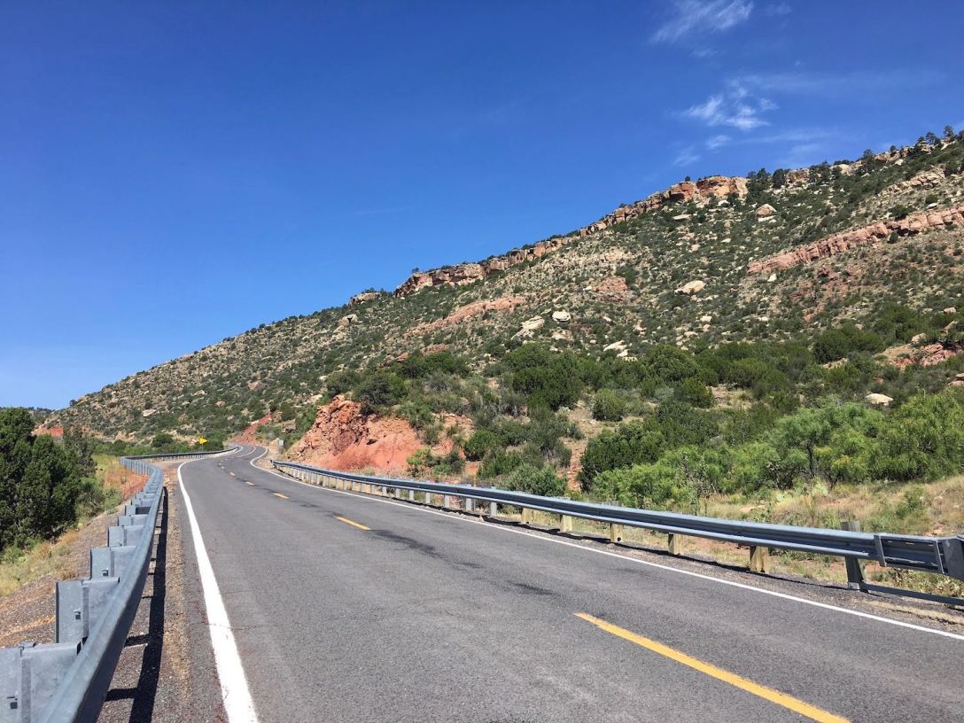
As NM-104 winds its way up Corazon Hill, a few pull-offs are provided for taking in the views or for nervous drivers in need of a break. Looking the direction from whence we came, I have views almost all the way back to Tucumcari.

I would very much like to know what this dirt road traveling up the escarpment leads to. Cave? Old mine? More secret Scientology stuff?

Tearing myself away from the view, we continue up, and in a dozen more miles we reach the old settlement of Trujillo, set in rolling grassy rangeland.

We are closing in on the Rockies now…

(The Other) Las Vegas
Our stay in Las Vegas is brief, just long enough for a quick walk around the train station vicinity and to check progress on the Castaneda Hotel restoration. A restaurant called Kin at la Castañeda has been opened on the first floor adjoining the bar area, also with seating on the wrap-around veranda. Although one wing of the hotel is still undergoing restoration/renovation, some rooms are already available.
From the pictures and early reviews, one can see that this restored Fred Harvey railroad hotel will be a very special place. This comes as no surprise because the massive project was undertaken by the hoteliers who restored the historic La Posada railroad hotel in Winslow, Arizona, and who also recently purchased The Plaza Hotel in Las Vegas just a mile or so away from the Castaneda. I have stayed at The Plaza (as have many actors and politicians) and am so excited to stay at the Castaneda on a future visit. La Posada is dog-friendly, and I’m hoping that the Castaneda will welcome our furry girl too!

My only other Las Vegas photo stop is at the Sunshine Motel, a filming location for the brilliant 2007 Coen Brothers flick No Country for Old Men. The movie was filmed all over Las Vegas actually, though I believe this is the only location I had not yet photographed.
Sidenote: I just checked out the motel’s facebook page and had a total WTF?! moment. In a wackadoo post dated April 2nd, an illiterate man named Jim Blackwell (representing the motel) proclaims that “God has asked women to be submissive” to men and from there spews forth homophobic religion-backed commentary interspersed with some cursing. Because you know, God definitely would have chosen this guy as his mouthpiece. Perhaps the motel’s facebook page was hacked by some radical nut, and does represent the views of the actual hotel management, though that’s doubtful. We are all entitled to our own beliefs, and I will declare one of mine: whomever created that facebook post is an ignorant a**hole.
Moving on to more pleasant subject matter…

NM Hwy 518 and NM Hwy 434
From Las Vegas we head north on NM-518. Soon after leaving town the weather turns, providing a couple of opportunities for nice raincloud pictures but mostly frustrating image results.
Hermit Peak (elevation 10,267) may not look that impressive from here, however it is quite an attractive natural landmark, rising 3,700 feet above the town of Las Vegas. The mountain’s namesake was an Italian religious hermit who, in the 1860’s, lived in a cave on a narrow ledge accessible only from the top of the mountain. The hermit inspired some devout New Mexicans to make pilgrimages to the cave during the hermit’s life and for some time after his passing.
Each time I come through this area I think to myself “next trip I will climb that mountain”. The trail to the peak is accessed from the NFS El Porvenir campground, which I always seem to forget about. So, next trip, yeah.

Reaching Mora, we turn north on another lonely road, NM Hwy 434. Mora is a very pretty old mountain town. Alas the weather is still not cooperating for picture-taking. Guadalupita looks like another good photo stop, though not for me, not today.
Coyote Creek State Park
Just north of Guadalupita we find a break in the rain, so I dip into Coyote Creek State Park to take Juniper for a walk and check out the campground for a potential future stay. The park is full on this Saturday, and honestly although the park is pretty, I am not drawn to the camping options (front country, overflow, and backcountry), which all seem oddly laid out. The single hiking trail is overgrown and I lose it quickly at the backcountry campground, so we walk the dirt road back through the frontcountry campground. Juniper enjoys her swim in Coyote Creek, which is narrow and shallow even in this snowy and rainy year. The wildflowers, creek, and mountain setting are scenic and lush by New Mexico standards, but to my surprise I feel kind of meh about this park.


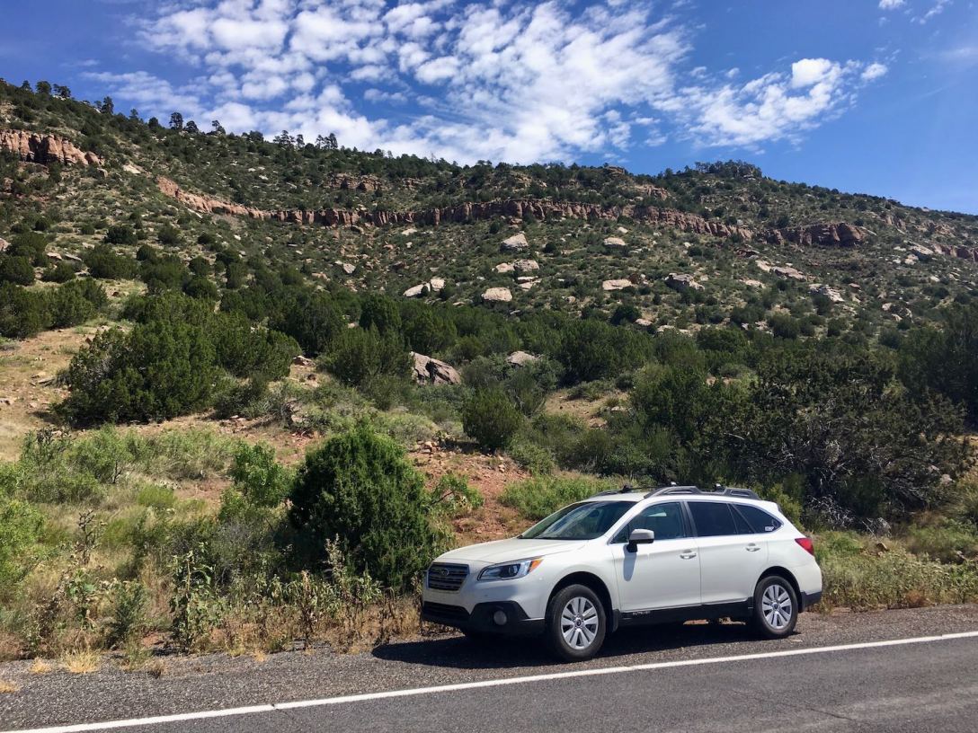
After our hour break at Coyote Creek SP, the Subie is once again headed northbound on NM-434, a true blue highway through gorgeous country, also a potentially dangerous road with some death curves.
Mindful of the time, I pass through the family-friendly, casual resort town of Angel Fire, where I hop on the Enchanted Circle, continuing north on US-64 to Eagle Nest Lake State Park. We do stop here for a few minutes because it’s just too pretty not to.


Carson National Forest near Red River
The rain is moving in again…prompting us to move on toward Red River via NM-38, and hopefully find a National Forest campsite for the night. As we climb in elevation, the rain is no longer intermittent, rather it appears to have been raining for a while. In several areas water and mud and small rocks are washing across the road. NM-38 is one of the most scenic roads in New Mexico, but also a little hairy in these conditions (thanks for getting me there safely, Subie!).
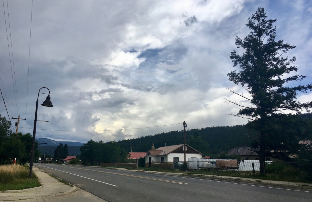
The bustling commercial stretch of Red River is not really my kind of tourist town, but provides a cell signal, so I park the car long enough for a leisurely phone call with Robert and to check the weather. I am loving the chill of the 45 degree temperature, however the forecast calls for rain, rain, rain all night.
A few miles east of Red River, I find an idyllic private NFS campsite complete with rushing creek, however I am not eager to be stuck sitting and sleeping in the car for the next 15 hours with a young dog who has been cooped up in it most of today too. Active bear warnings are posted at the campground, and without a bear box for food storage, Juniper and I would be unable to separate ourselves from the food in the car. I cannot shake the vision of being the obstacle between a black bear and that jar of peanut butter that he really wants to stick his snout in. Rather than spend a sleepless night with Juni bouncing off the Subie’s walls and both of us jumping at every sound in the deep dark forest, I decide to continue driving the Enchanted Circle to Taos and get a hotel for the night.
How pretty is my (almost) campsite in Red River?


Continuing west toward Questa, dropping elevation now…

Questa
I stop in Questa just long enough to photograph the backside of San Antonio del Rio Colorado Church, exquisitely set against the misty mountains. The front of the restored historic church may be seen (on a sunnier day) in my post about our Enchanted Circle loop last summer.

From Questa, I hop on NM-522 headed south toward Taos. One of my favorite captures of the day is this motion shot of Wheeler Peak (New Mexico’s tallest mountain) en route to Taos. I haven’t hiked this peak yet either, as summiting requires a long sunny summer day, being acclimated to the elevation, and planning ahead.

Luckily I had researched dog-friendly hotels in Taos as a backup, and headed for the Sagebrush Inn in Ranchos de Taos, where I paid a great last-minute rate on their one vacant pet-friendly room (Around $100 I believe, and on a Saturday night! Pictures forthcoming, in my next post). The Sagebrush Inn is historic, cute, homey, and super-clean. Juniper finds it perfect too. After a walk in the courtyard my travel companion crashes early and hard, as I pour through Taos tourist guides and dream of a life in this mountain town.
Next up, a walk around dog-friendly Taos! But first, here are a few tips for driving these blue highways:
- Be mindful of your gas gauge before you leave a city. Pumps can be few and far between, in fact I do not recall seeing a single one between Tucumcari and Las Vegas.
- Depending on the elevation, this region can be very hot in the summer and cold and snowy in the fall/winter/spring. Be aware of current weather and road conditions before heading up a lonely highway, and always come prepared with emergency supplies, including water and (seasonally) snow chains.
- Cell service is nonexistent for the majority of this route. I found a paper map helpful for navigation and inspiration. We like the Benchmark State Atlases – a great resource for wanderers because they include campgrounds and attractions.
See our first trip touring the Enchanted Circle, and more New Mexico wandering here.
Where else have we wandered? Check out our Parks List.

I want to be back out west so badly! We haven’t had the chance to explore NM hardly at all. Too bad the weather wasn’t better. I’d have been all over visiting Trementina!!!
LikeLiked by 1 person
Yeah, Trementina is fascinating. I will totally go exploring one day when my husband is along. Alone? Not so much!
LikeLiked by 1 person
Gee got that right. Ignorant a..hole. Wow…I’m glad you didn’t run into that guy.
LikeLiked by 2 people
NO WAY about Trementina!! I had no idea!! Also, there was an interesting show about Fred Harvey on 60 minutes (?) or could have been CBS Sunday morning (😩) last year. I loved it. My mother in law is a Fred Harvey history buff and gives speeches on the subject all the time!
LikeLiked by 1 person
Hahaha! That is so cool that your mother-in-law knows so much about the Fred Harvey history!I will have to check out the CBS story. It must have been such a fun experience to stay in one of those bustling hotels back in the day. I may try to recreate the experience (as closely as possible) by taking the train from Santa Fe or ABQ to Las Vegas for a weekend, then staying at the Castaneda.
LikeLiked by 1 person
I know right? Shes coming to Denver in a couple of weeks. I’m going to have her present to us what she does for her audiences! Ha! She doesn’t know that yet!! That trip would be loads of fun. It was definitely CBS Sunday morning…just found the you tube video on it 😊
LikeLiked by 1 person
How fun! I’ll check out that story when my husband joins me in NM this week. We used to watch Sunday Morning almost every week, but missed a bunch of episodes this past year, so it will be fun to catch The Harvey Hotel segment. Thanks so much!
LikeLiked by 1 person
We are looking to spend a few weeks to a month in New Mexico as soon as we can. Thanks for the detailed post we can use as a guide.
LikeLiked by 1 person
Thanks for reading! I’m glad my posts can provide some helpful info and/or inspiration. More Northern New Mexico posts upcoming. I’m actually in Ruidoso now 🙂 Good luck with your trip planning. I look forward to reading about your NM travels!
LikeLiked by 1 person
Wonderful 🙂
LikeLiked by 1 person
Thanks so much, Joshi!
LikeLike
Hi there. Im commenting on the cave/ mine photo. I have been out there and took pictures of this and have been intrigued as well. I cannot find anything at all about it after trying to research. Was curious if you found any information about it? Im so curious about what it is. Take care
LikeLiked by 1 person
Hi Jarron. I never did find anything out about the cave/mine. Next time I’m out that way, I will try to ask a ranger at Conchas Lake. Or maybe someone at the visitor center in Las Vegas knows something about it? Thanks for your comment, and good luck with your research!
LikeLike
I live right behind the old barn in the photo in Trujillo n hey 104. That was an old dairy and is currently being restored.
LikeLiked by 1 person
You are fortunate to live is such a beautiful place, Mark!
LikeLike
Oh, and btw, the Trementina ghost town is on private property you can’t go in there anymore. The owner threw me out last year.
LikeLiked by 1 person
Ah, good to know. Thanks for reading, and for your comments, Mark!
LikeLike