Days 16-19 (August 14-17)
Capitol Reef National Park, UT
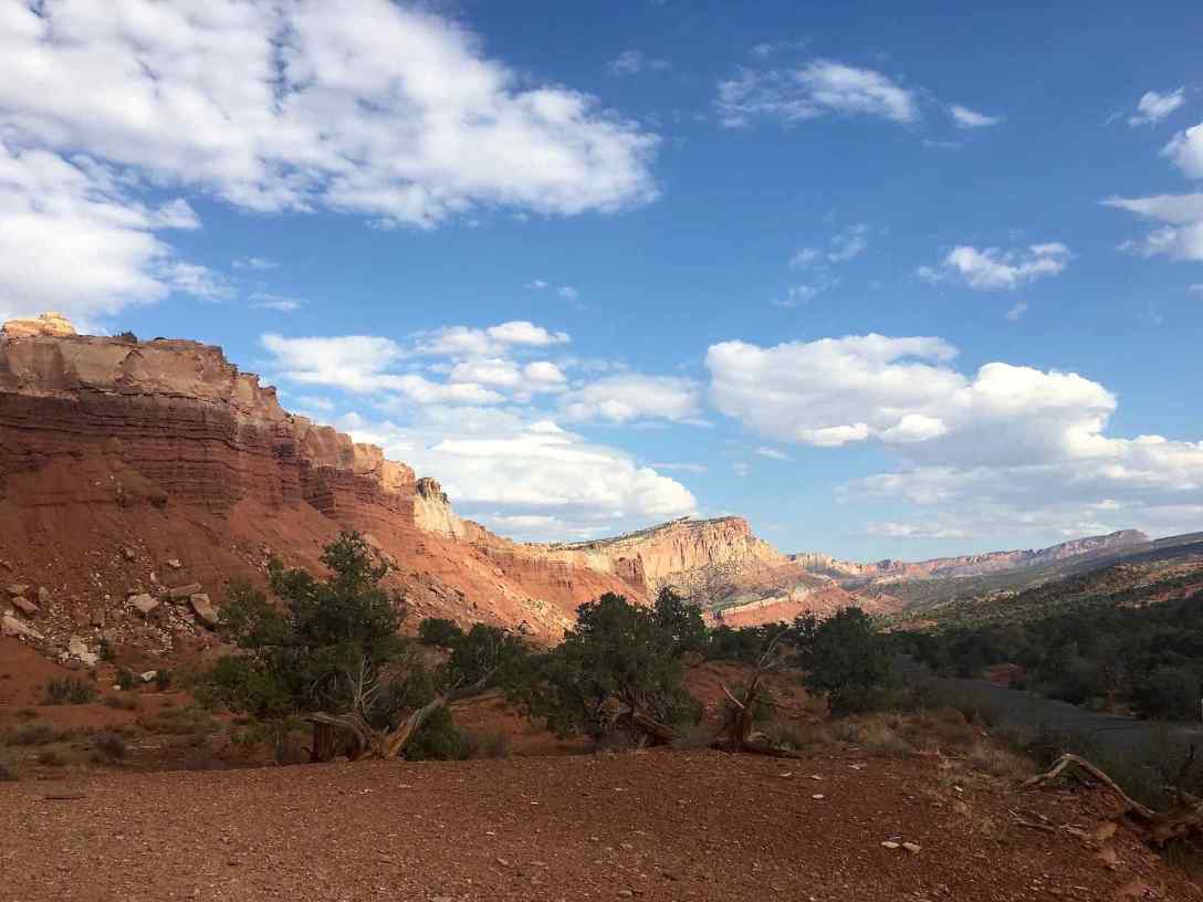
On a brief 24-hour visit in 2016, Capitol Reef National Park stole our hearts, and we are pumped to come back. This stay is an unexpected stop early in our trip and a re-route due to the wildfires, smoke, and haze in Colorado.
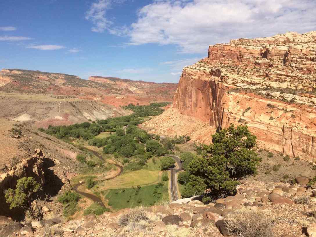
I find the drive in from the east or the west side of the park equally beautiful, although in very different ways. If you’re coming from I-70, be sure to stop at Hollow Mountain convenience store in Hanksville. As the name tells you, it’s built right into the rock, has a great book selection, clean restrooms, and friendly owners. The east side of Highway 24 (our route this time coming in) is extremely arid with sparse greenery, but for the massive gray buttes and the San Rafael Swell rising from the earth. I love this scenery but there are not enough pull-offs for photography and it is already nearing 5pm by this time, so we do not stop off for photos. Next time!
Arriving at our campsite, we are still whipped from our killer hike and marathon swim session in Ouray, so we set up camp and just enjoy eating and sitting and watching the light change in this beautiful place.
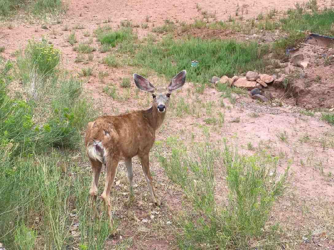
Mule deer live in the campground and aren’t very shy.
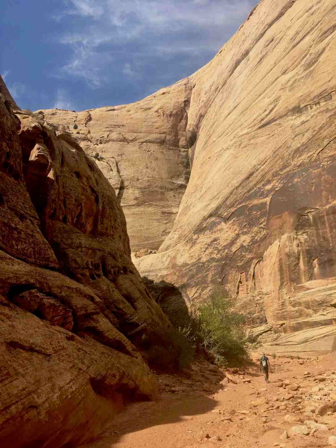
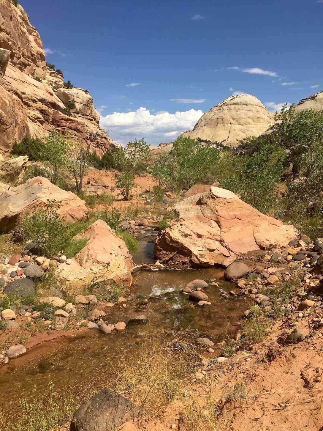
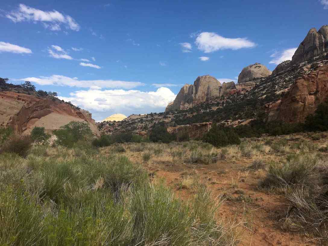
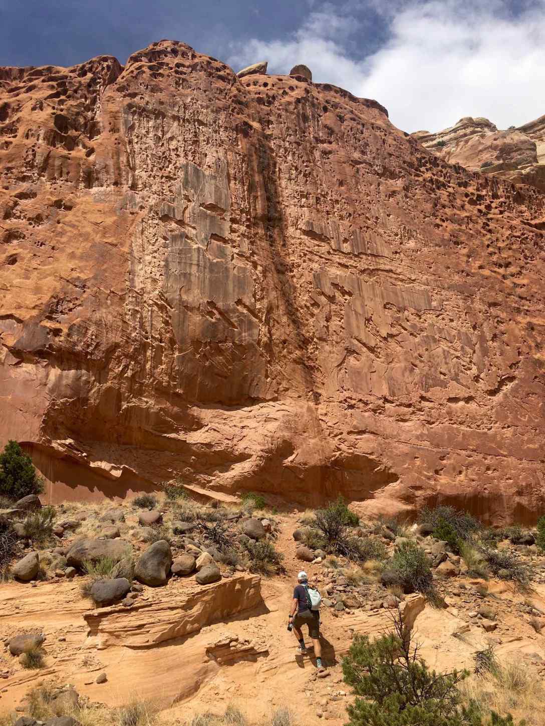
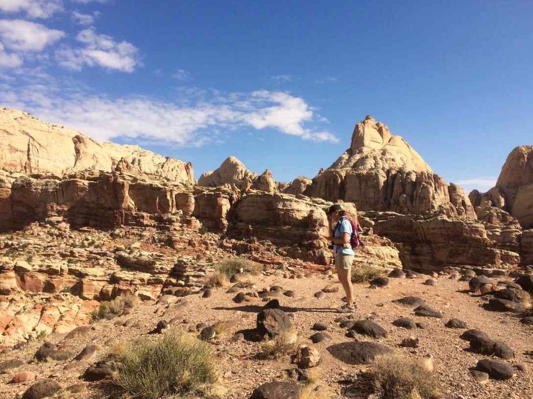
The following day we hike The Grand Wash trail from Hwy 24 and up to Cassidy Arch, about 8 miles total. The Grand Wash doesn’t have much elevation gain, but one is walking through dry river bed, so it’s considered a “moderate” 2.4 mile (each way) hike. It’s an awesome trail with towering cliff walls, one I will definitely hike again.
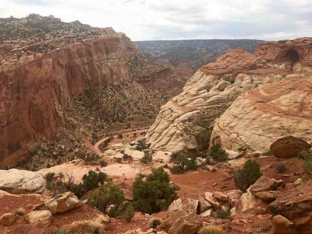
We connect to the Cassidy Arch trail , which gets it’s name from the legend that Butch Cassidy and his gang hid out from the law here. A strenuous trail due to elevation gain, high steps, and precarious slick rock crossings near the top, the hiker is rewarded with a magnificent arch that is seen both from a side viewpoint and the top.
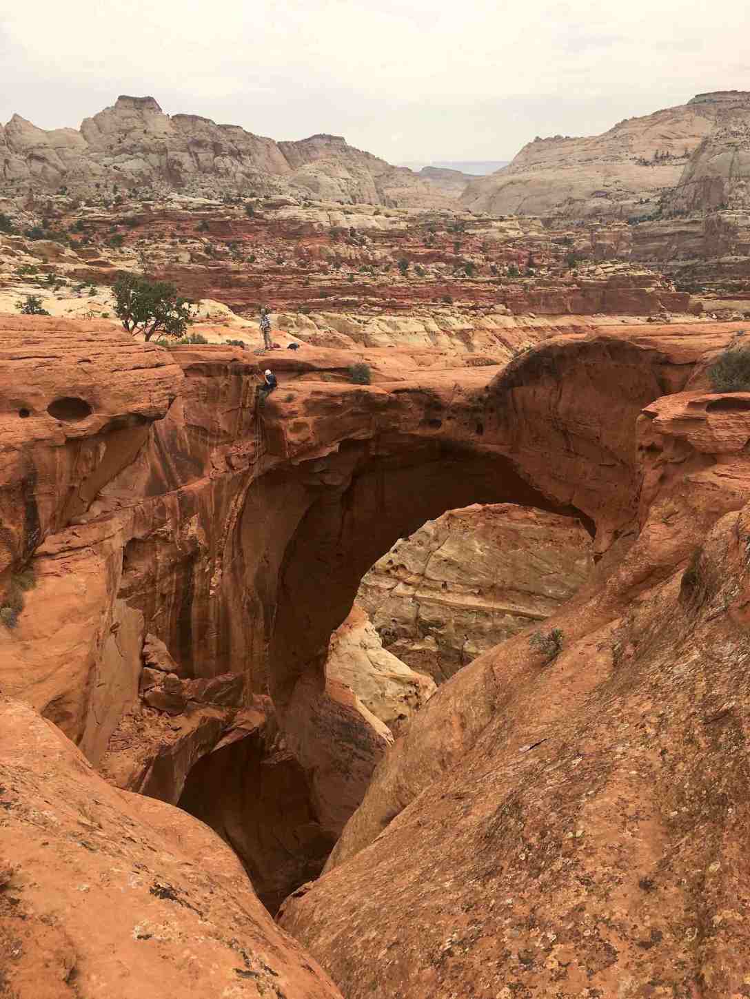
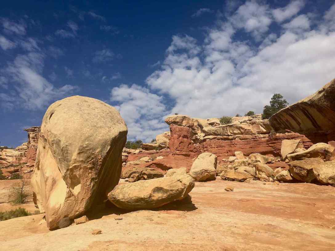
There is a large expanse of slickrock at the top perfect for eating lunch or a snack and just enjoying the views. A few older gents were starting to rappel down just as we arrived. A fellow hiker mentioned that she heard them say there were 7 drops to get to the bottom. Whoa, I hope I’m doing stuff like this when I’m nearing 60!
Whipped but feeling great after our hike, we devour the best peach pie ever from Gifford House, drive the scenic road to the end of the pavement, pop the Subie into X-mode for the final a couple of unpaved miles to Capitol Gorge. We hike in about a mile (one way) to view petroglyphs and early “Joe was here” type scratching as into the rock from the early Mormon settlers of the area and more modern graffiti artists. It’s too dark in the gorge for good photos.
We cook dinner & watch the seasonal ranger’s interpretive program on astronomy. Capitol Reef is a dark-skies park. We haven’t been lucky enough to experience a cloudless sky (with milky-way visible) yet, however we are still treated to a great star-filled sky, with no light pollution as we’d experience back home or any just about any city. We are too tired to stay up and see if the clouds clear and say we will the next night, although we won’t.
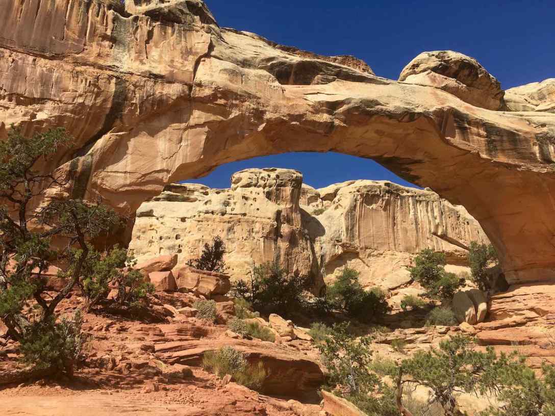
Our second morning at Capitol Reef is spent hiking the 1.8 mi (round-trip, moderate) trail to Hickman Bridge – a great hike to take if you have limited time in the park. After this hike we drive into the sweet town of Torrey for ice, lunch, and fresh-baked bread from Chuckwagon General store and Deli. We run into the Gifford House for another pie – apple this time – to have after dinner.
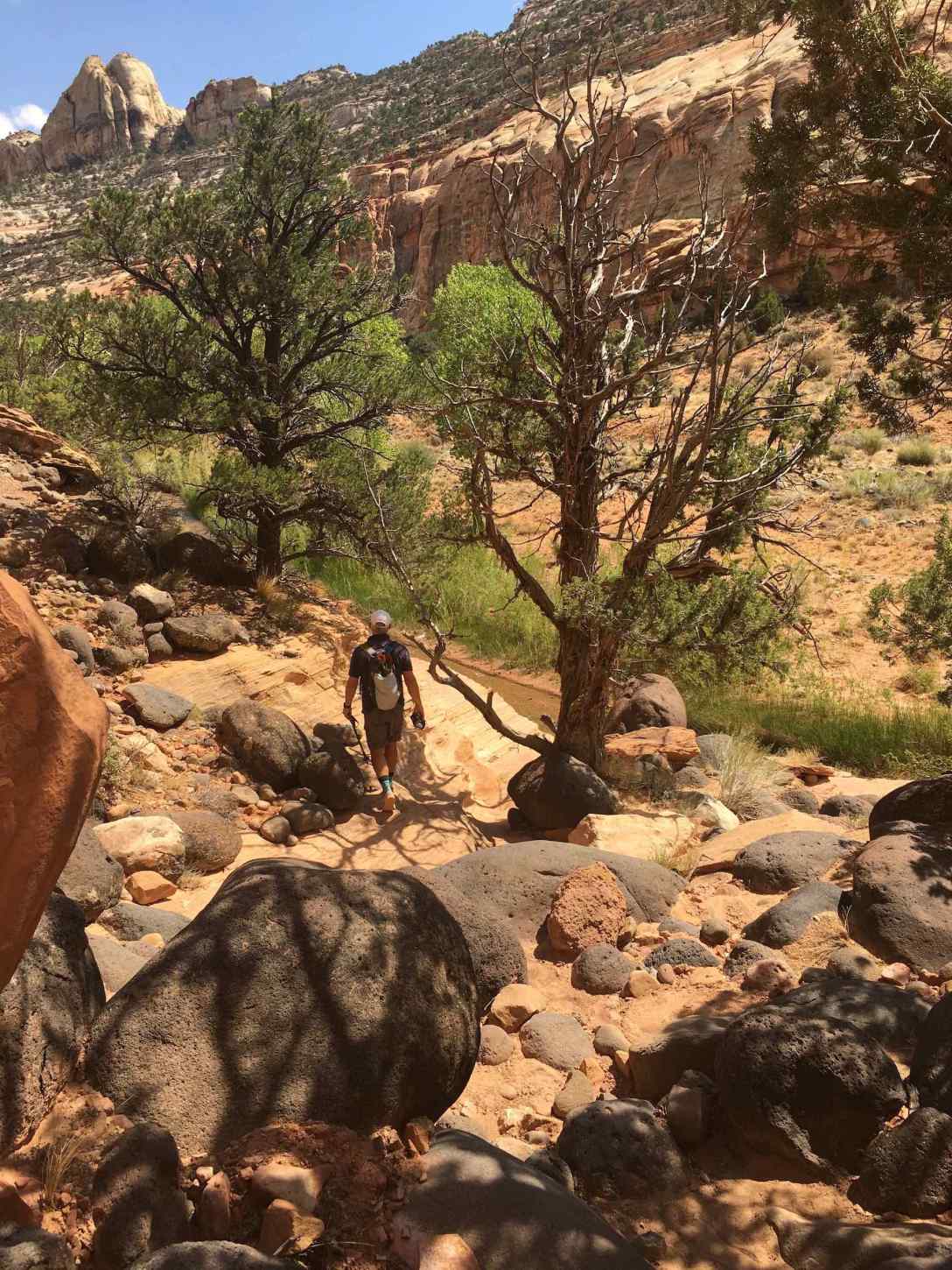
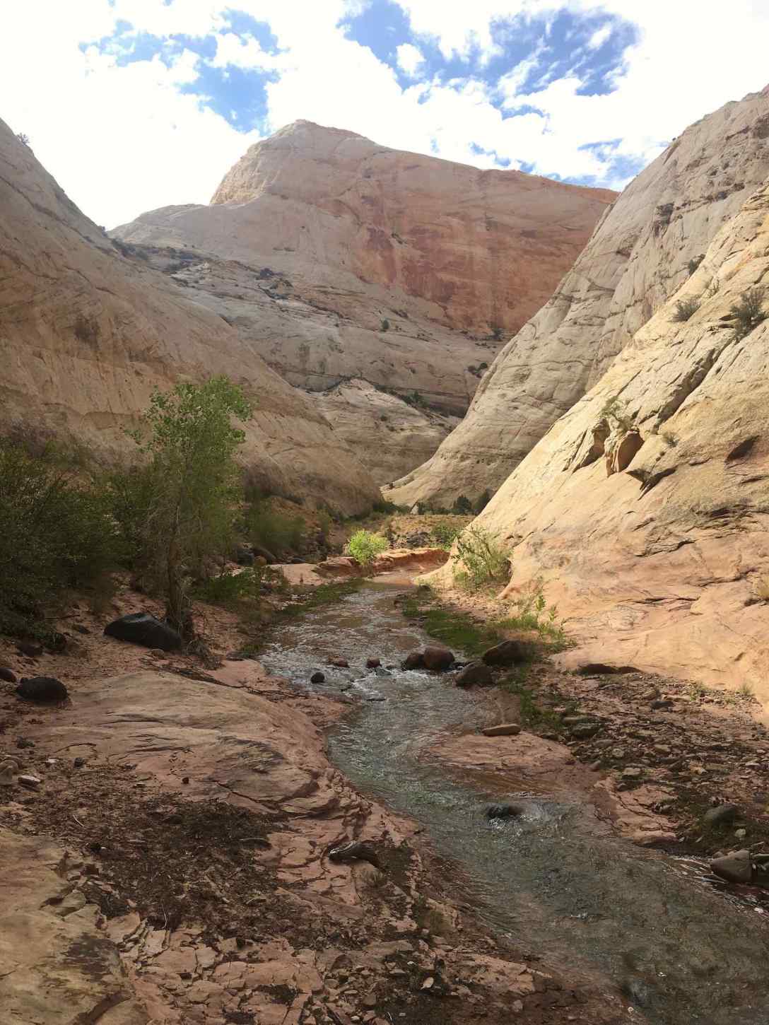
Although this park is very quiet compared to most national parks, craving real solitude and a more backcountry trail, we decide to hike the Pleasant Creek trail in a quiet portion of the park. Reaching the trailhead requires taking the 9-mile scenic drive to the end followed by a few miles of what should be considered (although is not marked) a 4WD road.
The first half mile of the Pleasant Creek trail is hard to follow in areas, as it requires a number of creek crossings. I manage to rock hop and keep my feet dry the entire trail, but this requires carefully choosing one’s crossing areas.
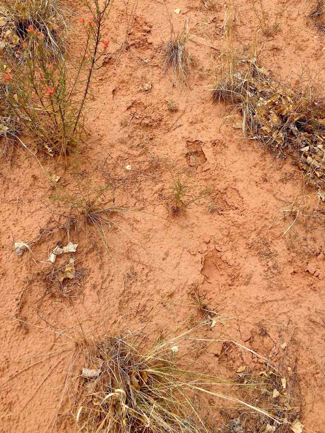
In one area we lose the trail and spy fresh mountain lion tracks(!)
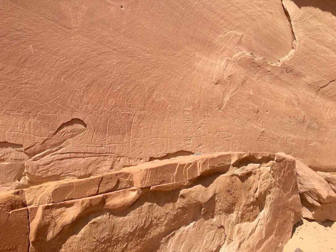
A scramble up a small hill takes one to a Fremont petroglyph panel.
Although this trail doesn’t have much elevation gain or loss, I would consider it moderate due to deep sand and creek crossings. We hike quite a bit beyond the creek’s cascades through sandstone chutes, so I estimate we hike about nine miles.
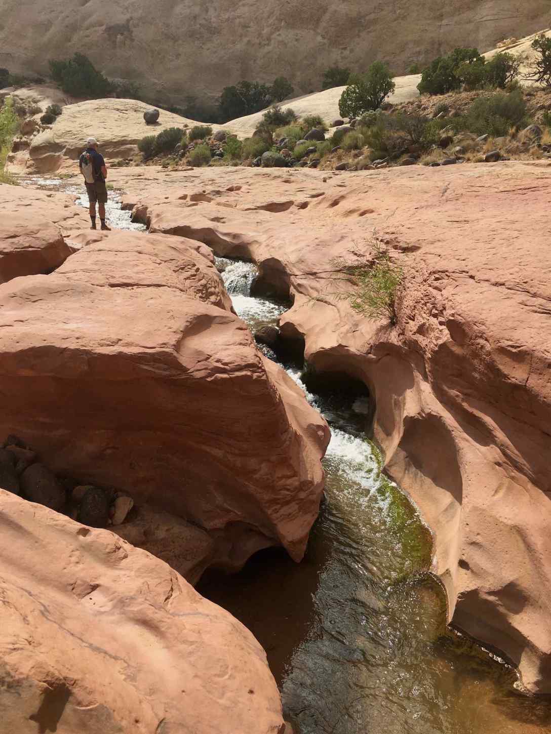
There are some areas great for a lunch stop and cooling off one’s feet in the creek. This is an awesome trail for those who don’t mind doing a little route-finding and the possibility of getting wet. That being said, watch the forecast and don’t hike in rainy weather!
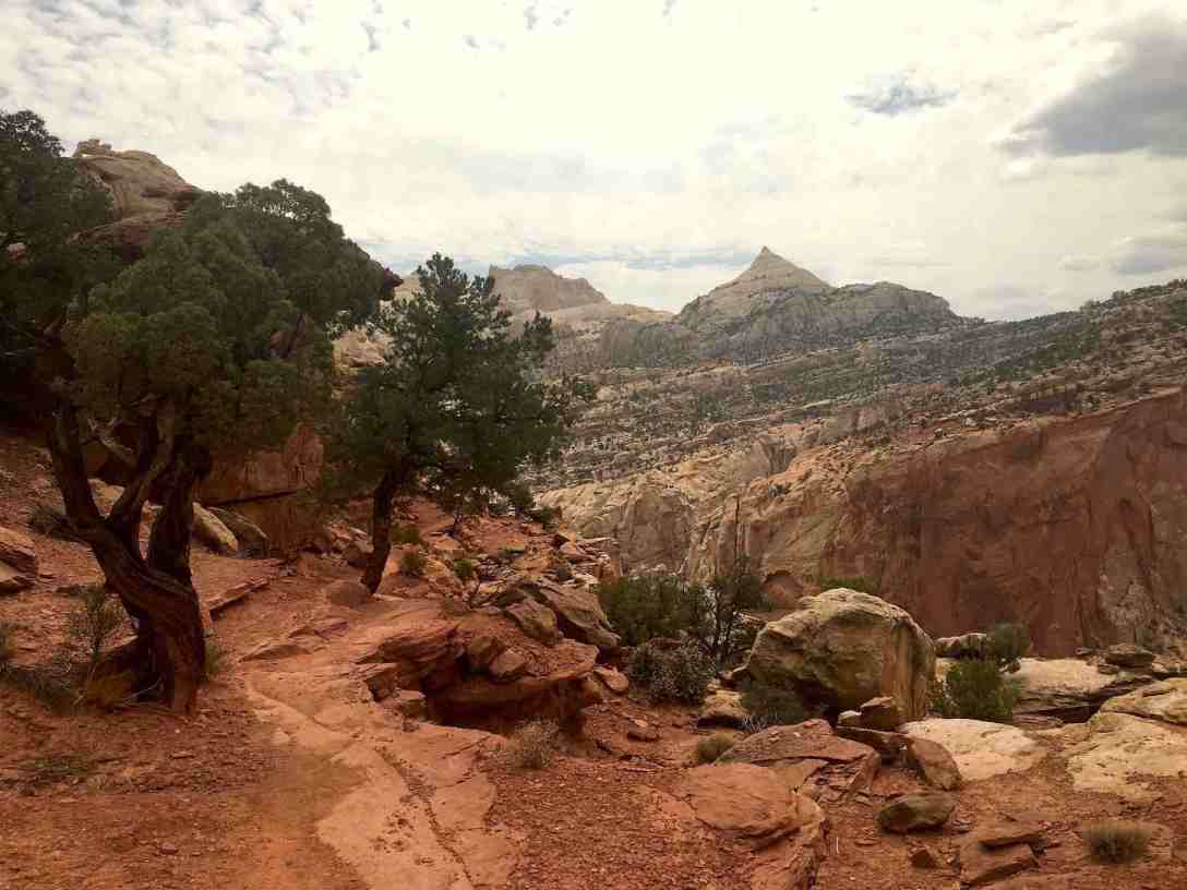
A morning hike up to the Fruita overlook via the Cohab Canyon trail is a must-do before we leave.
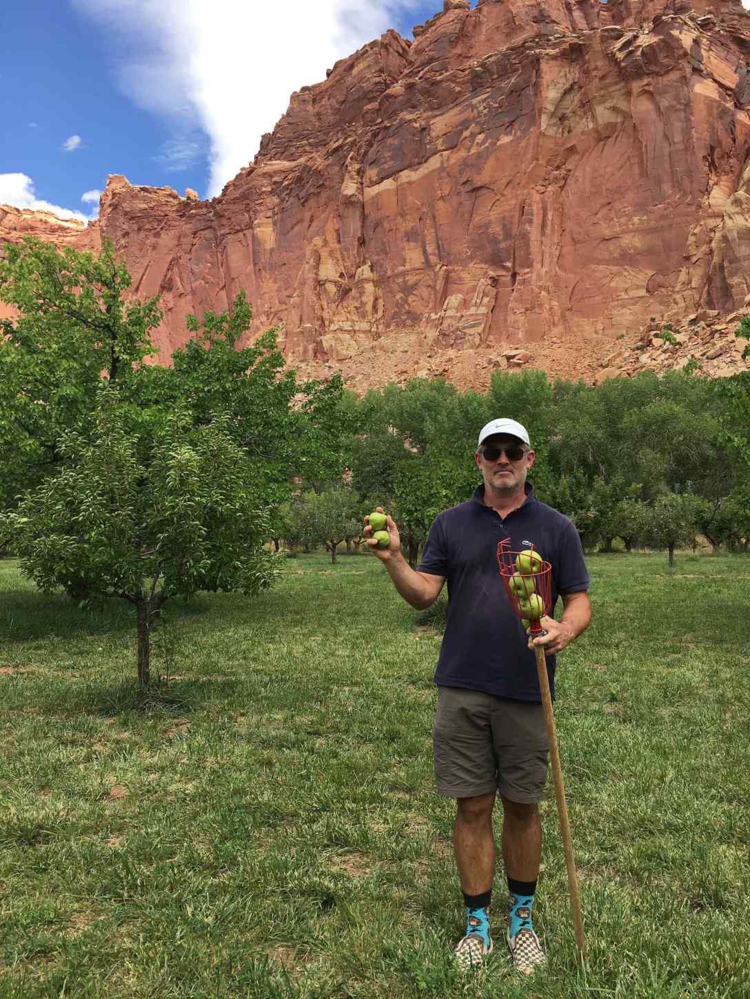
Before we leave Capitol Reef we pick some apples in a Fruita Orchard.
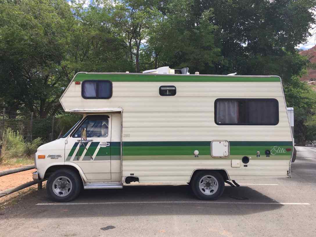
On our way out, we spy an awesome vintage RV, and predict that in a couple of months when the weather cools, we will be wishing we had one for those freezing nights.
En route west (in Bicknell I believe), I spy this sign. Utah humor!

Capitol Reef looks magnificent! What fabulous photos. I’m sure the hiking there was amazing. Thanks for sharing. I can’t wait to go out west again. 🙂
LikeLike
Thank you! Capitol Reef is a very photogenic park, with a great variety of hikes. We love it so much that we returned in October on our way back east and were lucky enough to catch peak fall color. I highly recommend spending a few days there!
LikeLike
I hope to make it there in the next several years, Marsi! Thanks for sharing. 🙂
LikeLiked by 1 person
So very cool! You visited some areas we didn’t and got to pick apples too! We are thinking about maybe renting an RV next time… who knows!
LikeLiked by 1 person
Thanks for stopping by, and for your comment! It was really fun getting to pick apples and pears in the orchards. In a few weeks (hopefully) I will get around to posting about our October visit. Capitol Reef was gorgeous with the Cottonwoods in bloom along the Fremont River. But really, it’s gorgeous in any season!
LikeLiked by 1 person
Is ‘slickrock’ just the name of a certain kind of rock or is it actually slick, or both? ( :
LikeLiked by 1 person
Good question! Slickrock is smooth weathered sandstone. Unless there is loose sand resting on the surface, slickrock is not slick when dry (at least not if one is hiking it in shoes with decent traction), however I’m not sure if I’ve ever hiked it when wet. This forum has a couple of interesting suggestions of the origin of “slickrock”: https://english.stackexchange.com/questions/285899/what-is-slickrock
LikeLike